Article 7 — Overlay Districts, Chapter 7-5 — GROUNDWATER RECHARGE AREA PROTECTION OVERLAY
Purpose and Intent
Groundwater is among the nation's most important natural resources. It provides drinking water to urban and rural communities, supports irrigation and industry, sustains the flow of streams and rivers, and maintains riparian and wetland ecosystems. In many areas of the nation, the future sustainability of ground-water resources is at risk from contamination. Because groundwater systems typically respond slowly to human actions, a long-term perspective is needed to manage this valuable resource. This chapter is intended to implement rules of the state department of natural resources environmental protection division known as the "Rules for Environmental Planning Criteria" as they specifically relate to groundwater recharge areas (Rule 391-3-16-.02).
It is essential to the health, safety, and welfare of the public that the quality of subsurface public drinking water supplies be maintained. Groundwater resources exist in underground reservoirs known as aquifers. These aquifers are zones of rock beneath the earth's surface that are capable of producing water through a well. They occupy vast regions of the subsurface and are replenished by infiltration of surface water runoff in zones of the surface known as groundwater recharge areas. Groundwater is susceptible to contamination when unrestricted development occurs within significant groundwater recharge areas.
Certain land use activities, such as septic tanks, underground tanks, and chemical spills, pose a threat to the quality of groundwater supplies. Therefore, it is necessary to manage land uses within groundwater recharge areas to ensure that pollution threats are minimized. To this end, this chapter establishes minimum lot sizes to provide for the orderly and safe development of property utilizing on-site sewage management systems.
Definitions
Acre-foot. The volume (as of irrigation water) that would cover one acre to a depth of one foot.
Aquifer. Any stratum or zone of rock beneath the surface of the earth capable of containing or producing water for a well.
DRASTIC. The standardized system for evaluating groundwater pollution potential using the hydrogeologic settings described in U.S. Environmental Protection Agency document EPA-600-2-87-035. (Note: the DRASTIC methodology is the most widely used technique for evaluating pollution susceptibility).
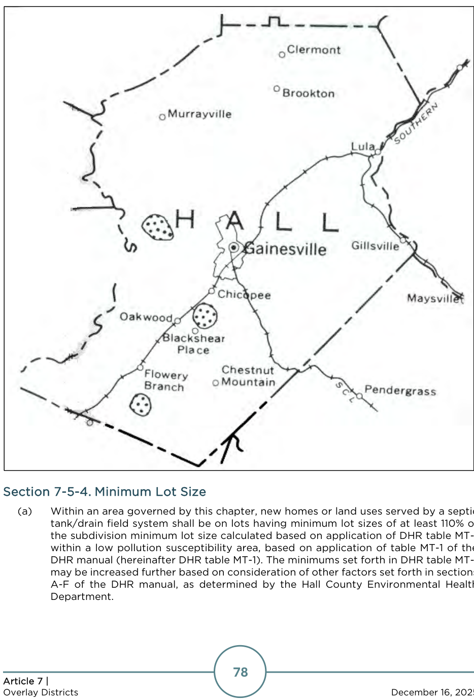
Hydrologic atlas 18. A map prepared by the state department of natural resources and published by the Georgia Geologic Survey in 1989, which identifies the most significant groundwater recharge areas of the state as spotted areas labeled as “areas of thick soils.”
Hydrologic atlas 20. A multicolored map of the state at a scale of 1:500,000, prepared by the state department of natural resources using the DRASTIC methodology and published by the Georgia Geologic Survey in 1992, which shows areas of higher, average (or medium), and lower susceptibility of groundwater to pollution in the state. This map is also commonly known as the Groundwater Pollution Susceptibility Map of Georgia. Note: This map shows all areas in Hall County as “lower” pollution susceptibility.
Pollution susceptibility. The relative vulnerability of an aquifer to being polluted from spills, discharges, leaks, impoundments, applications of chemicals, injections and other human activities in the recharge area. Each significant recharge area shown on hydrologic atlas 18 is classified on hydrologic atlas 20 as higher, average, or lower pollution susceptibility.
Recharge area. Any portion of the earth’s surface where water infiltrates into the ground to replenish an aquifer.
Significant recharge area.: Those recharge areas mapped by the state department of natural resources in hydrologic atlas 18 (1989 edition) within the relevant portion of Hall County. Each significant recharge area shall be determined to have a pollution susceptibility of high, medium, or low based on hydrologic atlas 20. Note: All areas in Hall County are “lower” pollution susceptibility.
Boundaries and Map
The groundwater recharge area protection overlay zone is hereby designated and shall consist of the land areas within the jurisdiction of the City that are mapped as significant recharge areas by the State Department of Natural Resources in hydrologic atlas 18, 1989 edition. The boundaries of the overlay zone are defined on the Official Zoning Map.
Minimum Lot Size
Manufactured Home Parks
Manufactured home parks are prohibited within this overlay zone.
Agricultural Waste Impoundment Sites
New agricultural waste impoundment sites which exceed 50 acre-feet in a significant recharge area shall contain a liner consisting of compacted clay having a thickness of one-foot and a vertical hydraulic conductivity of less than 5 x 10⁻⁷cm/sec or other criteria established by the natural resource and conservation service.
Above Ground Chemical or Petroleum Storage Tanks
Within an area governed by this chapter, new above-ground chemical or petroleum storage tanks having a minimum volume of 660 gallons shall have secondary containment for 110 percent of the volume of such tanks or 110% of the volume of the largest tank in a cluster of tanks. Such tanks used for agricultural purposes are exempt, provided they comply with all federal requirements.
Hazardous Materials Handling Facilities
Within an area governed by this chapter, new facilities that handle hazardous materials of the types listed in section 312 of the Resource Conservation and Recovery Act of 1976 (excluding underground storage tanks) and in amounts of ten thousand (10,000) pounds or more on any one day, shall perform their operations on impervious surfaces and in conformance with any applicable federal spill prevention requirements or the requirements of the Standard Fire Prevention Code.
County Environmental Health Department Approval Required
No development permit or building permit shall be issued by the community and economic development department or the building official for a building, structure, or manufactured home to be served by a septic tank, unless the Hall County Environmental Health Department first approves the proposed septic tank installation as meeting the requirements of the state department of human resources manual.
Site Guidance for Groundwater Infiltration Best Management
Practices (BMPs)
Permanent stormwater infiltration devices are prohibited by the Georgia Planning Act in areas having high pollution susceptibility. Avoid the use of infiltration devices at stormwater hotspots and in areas known to provide groundwater recharge to water supply aquifers, unless adequate pretreatment is provided upstream and a liner is installed to prevent pollutants from reaching underlying groundwater aquifers. Infiltration BMPs should only be applied on development sites that have permeable soils (i.e., hydrologic soil group A and B soils) and that have a water table and confining layers (e.g., bedrock, clay lenses) that are located at least two feet below the bottom of the trench or basin. Follow design guidance in the Georgia Stormwater Management Manual (GSMM).